 |
Geographic Information Technology, CyberTracker and Local Spatial Knowledge
Duration: 2:44
Recommended for use in: M01, M09 |
| Louis Liebenberg, founder and developer of CyberTracker technology, shares his views on the importance of maintaining local knowledge and on being aware that technology may seduce users at the cost of disempowering local knowledge holders. Liebenberg further highlights the role of the "Training Kit on Participatory Spatial Information Management and Communication" in empowering grassroots activities. ... more.
|
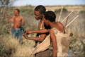 |
Tracking in the Cyber Age
Duration: 7:33
Recommended for use in: M09 |
| This eight-minute video on CyberTracker covers a number of ways in which geospatial information technology (GIT) can be used in the contexts of development and conservation. In addition it highlights how GIT can add value to indigenous peoples’ knowledge systems and how this can have important applications in protected areas and collaborative natural resource management. The video has been produced as part of the project "Support the spread of good practice in generating, managing, analysing and communicating spatial information". CyberTracker is an open-source software developed in South Africa by CyberTracker Conservation, with financial support initially provided by the European Commission. It can be installed on a Global Positioning System (GPS) -enabled hand-held device such as a Personal Digital Assistant or a Smartphone to collect geo-referenced data with detailed digital notation. It is a highly efficient way to gather large quantities of geo-coded field observations at a speed and level of detail not possible before. CyberTracker allows users to customise the interface to meet data collection needs. Screen designs can combine text and icons to optimise efficiency and customisation. The CyberTracker icon interface was originally designed for trackers who could not read or write. Nowadays all users, including scientists and conservationists, are benefitting from the icon-based interface because it enables much faster data entry. ... more.
|
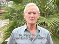 |
Peter Poole reports on his experience with community mapping
Duration: 9:59
Recommended for use in: M09 |
| In this interview, Peter Poole, Director of Local Earth Observation (LEO), Netherlands, traces the evolution of a map-making methodology which began with the introduction of Global Positioning System (GPS) to the Inuits in 1989 and evolved throughout the 1990s in a series of projects in the Amazon, the Arctic and Asia. Tenure maps depict indigenous names, resources and special places on scaled maps, intended as evidence in negotiating processes. Peter describes the search for an inexpensive, simple, appropriate geomatic technology. Community-based teams would gather raw field data, and indigenous associations or support non-governmental organisations set up mapping units to serve the field teams. Three lessons are described: (i) communities can make their own scaled maps; (ii) emerging mapping centres should make their services accessible to all communities; and (iii) the methodology not only produces a tenure map, but also equips and inspires community mappers to diversify their skills in environmental information management. ... more.
|