 |
Introduction to GIS
Duration: 5:49
Recommended for use in: M12 |
| Understand what GIS is and for what it can be used. With a GIS application, you can open digital maps on your computer, create new spatial information to add to a map, create printed maps customised to your needs and perform spatial analysis. This video explores the basic concepts behind geographical information systems. ... more.
|
 |
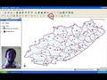
Vector Data
Duration: 9:14
Recommended for use in: M12 |
| Understand vector data models as used in GIS. Vector data provide a way to represent real world features within the GIS environment. A feature is anything you can see on the landscape such as houses, roads, trees, rivers and so on. Each one of these things would be a feature when we represent them in a GIS application. Vector features have attributes, which consist of text or numerical information that describes the feature. This video explores the different geometry types used to represent vectors. ... more.
|
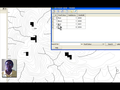 |
Attribute Data (Part 1)
Duration: 4:58
Recommended for use in: M12 |
| (Part1) Understand the role of attribute data in GIS. Attribute data describe features. Attribute data can help us make interesting and informative maps, and perform spatial analysis in a GIS application. This video describes how attribute data are associated with vector features and can be used to symbolise data. ... more.
|
 |
Attribute Data (Part 2)
Duration: 11:06
Recommended for use in: M12 |
| (Part 2) Understand the role of attribute data in GIS. Attribute data describe features. Attribute data can help us make interesting and informative maps, and perform spatial analysis in a GIS application. This video describes how attribute data are associated with vector features and can be used to symbolise data. ... more.
|
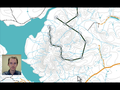 |
Digitising Vector Data
Duration: 10:20
Recommended for use in: M10U04, M12 |
| Learn how to create and edit vector and attribute data. In the previous two videos the producer discussed vector data namely geometry and attributes. The geometry of a vector feature describes its shape and position, while the attributes of a vector feature describe its properties (e.g. colour, size, age). This video describes the process of creating and editing vector data – both the geometry and attributes of vector features. ... more.
|
 |
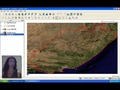
Raster Data
Duration: 10:22
Recommended for use in: M12 |
| Discover the different kinds of raster data and how they can be used in GIS. Raster data are arranged in a matrix of cells. Each cell in the matrix has a value. When viewed as a whole, the raster looks like an image. This video takes a closer look at raster data. ... more.
|
 |
Topology
Duration: 11:50
Recommended for use in: M12 |
| Topology defines the relationship between vector features. This video elaborates on how topology is used in GIS, and the differences between topological and non-topological datasets. It looks also at how topological concepts can be used to improve the digitising process. ... more.
|
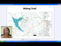 |
Map Production
Duration: 11:13
Recommended for use in: M12 |
| Understand map production for spatial data. Map production is the process of arranging map elements on a sheet of paper so that, even without many words, a lay person can understand what it is all about. Maps are very often produced for presentations and reports where the audience or reader is a politician, citizen or learner with no professional background in GIS. Because of this, a map has to be most effective in communicating spatial information. This video explores the common elements of a map and how they can be combined to create a pleasing product. ... more.
|
 |
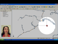
Spatial Analysis: Vector Data
Duration: 8:34
Recommended for use in: M12 |
| Understand the use of buffering in vector spatial analysis. Spatial analysis uses spatial information to extract new and additional meaning. Usually spatial analysis is carried out using a GIS application. A GIS normally has spatial analysis tools for feature statistics (e.g. how many vertices make up this polyline?) or geo-processing, such as feature buffering (e.g. which area falls within a certain distance of this feature?). This video looks more closely at vector analysis, using buffering as an example. ... more.
|
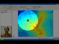 |
Spatial Analysis: Raster Data
Duration: 8:53
Recommended for use in: M12 |
| Understand interpolation as part of spatial analysis. Spatial interpolation is the process of using points with known values to estimate values at other unknown points. This video describes interpolation in more detail and gives some examples of how it can be useful. ... more.
|