
Title: Attribute Data (Part 1)
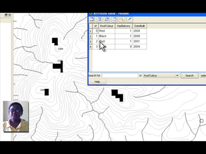
Summary: (Part1) Understand the role of attribute data in GIS. Attribute data describe features. Attribute data can help us make interesting and informative maps, and perform spatial analysis in a GIS application. This video describes how attribute data are associated with vector features and can be used to symbolise data.
Producer: Chief Directorate: Spatial Planning & Information, Department of Land Affairs, Eastern Cape, South Africa
Director: Tim Sutton
Source language: English; Subtitles: none
Genre: Tutorial
Duration: 4:58
License: Attribution-Noncommercial-No Derivative Works 3.0 Unported
Recommended for use in Module(s): M12
File Format: mov
Note: This video production is available on Disk No. 2
