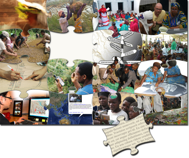
Training Kit on Participatory Spatial Information Management and Communication. CTA/IFAD
Module M01 - Introduction to the Training Kit
This Module introduces the trainer and the trainee to the main topic of this Training Kit – Participatory Spatial Information Management and Communication. It presents the project’s rationale which led to its production, and explains how it has been designed for use in face-to-face workshops. It describes the Training Kit’s modular structure and how its building blocks can be "mixed and matched” to assemble a tailored curriculum. The Creative Common licensing scheme upon which the content can be used and republished is introduced. This Module also includes one Unit about how to support the adoption and improvement of the Training Kit and how users can keep in touch with peers over the Internet.
 Photo by: Ana Paula Medvedeva
  Some rights reserved
This Module is a must-read for any trainer. It has to be included in the curriculum when training trainers. When training people who only implement activities in the field, some Units may be omitted.
Module M02- Attitudes, Behaviours and Ethics
This Module addresses the core values of the training kit. It must be included in the training curriculum. It covers the ethics in the practice and is meant to heighten awareness among trainees about the risks involved in poor or careless practise. The Module covers topics like personal and team attitudes and behaviours, communication skills for PGIS facilitators, relationships between facilitators and communities and “free, prior and written informed consent” issues.
 Photo by: Majumdar Sandipan Some rights reserved
This is a key Module to be included in any curriculum, as it represents the core of this Training Kit.
Module M03 - Fundamentals of Training Delivery and Facilitation
This Module aims to prepare users to function as trainers for PGIS training. Having a skill or specialised knowledge does not mean that a person can train others in that skill or impart knowledge. The Module introduces concepts and principles of training and steps to follow when preparing a training activity. It also provides tools for conducting training needs assessment and for planning and structuring the training. It focuses on training implementation and evaluation.
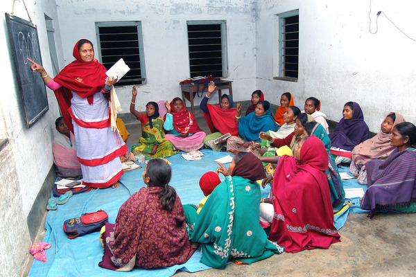 Photo by: Abhijit Dey Some rights reserved
This Module is a must-read for any trainer. It has to be included in the curriculum when training trainers, especially when the trainees have insufficient knowledge and skills for delivering training.
Module M04 - Community Groundwork and Processes
This Module covers aspects of the social and political context(s) within which facilitators and intermediaries are going to work. It is meant to provide the basics of community groundwork and processes. These include knowing how to identify entry points to any given community, build rapport, develop communication processes and mobilise and organise the community or community groups for participating in participatory mapping. The underlying hypothesis is that communities are not homogenous; intermediaries need to understand them in terms of how they are organised and their power and power relations. This understanding will provide facilitators and intermediaries with an opportunity to learn how best to interact and relate with local communities and structures and ensure equitable participation and informed decision making.
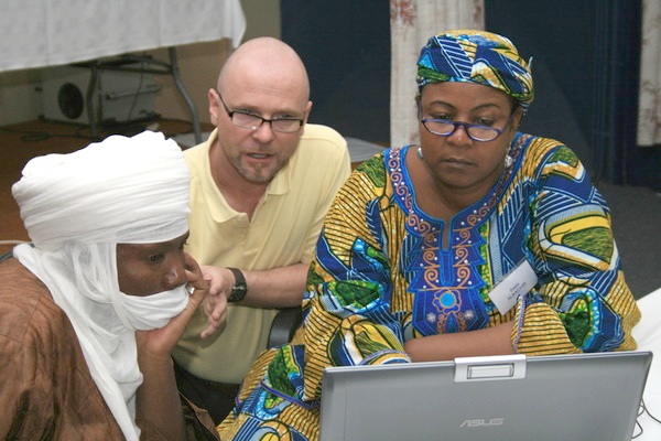 Photo by: Giacomo Rambaldi Some rights reserved
This Module is for trainees who have limited experience with community work and for researchers and government officials.
Module M05 - Enabling and Disabling Environments
This Module addresses the identification and analysis of factors that affect the implementation of community processes that work with spatial information. The factors can impact the process either negatively (disabling factors) or positively (enabling factors).
This Module analyses whether such enabling or disabling factors are internal or external. It also exposes the trainees to a process to create a strategy and action plan that builds on enabling factors and addresses disabling factors. It recommends SWOT analysis as the tool for best identifying and evaluating the strengths, weaknesses, opportunities and threats that organisations and project implementers may face in projects with a participatory mapping component.
 Photo by: Stewart Brown Some rights reserved
This Module helps trainees understand the internal and external factors influencing the success or failure of initiatives with PGIS-related components.
Module M06 - Choice of Participatory Mapping Method based on Purpose, Environment and Resources
PGIS practitioners use a range of geographic information technologies for acquisition, validation, analysis, representation and sharing of geo-spatial information. This Module provides trainees with a framework for choosing the most appropriate method to suit their needs. There are a number of factors that influence this choice. These include the purpose behind the initiative, the resources available and the institutional and environmental setting. Through a series of presentations, interactive question and answer sessions and exercises, trainees are exposed to the factors that should be considered when making decisions with respect to selecting mapping methods to fit specific contexts.
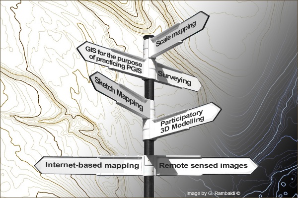 Image by: Giacomo Rambaldi Some rights reserved
This Module offers trainers and trainees insight into all participatory mapping methods included in the Training Kit, including their strengths and weaknesses.
Module M07 - Project Structuring and Initial Reconnaissance
Project structuring and initial reconnaissance are crucial for the success of any initiative incorporating a PGIS component. This Module deals with essential tasks to be performed while preparing the ground for a participatory mapping initiative. These include: (i) assembling a Core Team, (ii) designing the project and arranging financing; (iii) visiting communities; (iv) visiting government agencies and non-governmental organizations (NGOs); and (v) making logistical arrangements for the mapping exercises. This Module takes into consideration that there are different mapping methodologies and that some of these may require specific tasks.
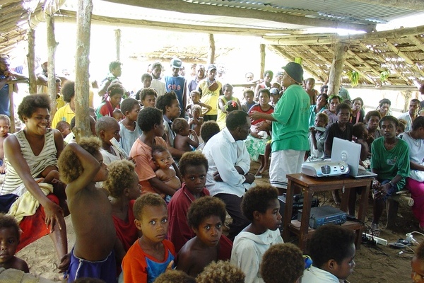 Photo by: Matt Fossey Some rights reserved
This Module familiarises trainees with critical pre-mapping activities on which the success of a project may depend. It is recommended as part of any curriculum based on this Training Kit.
Module M08 - Ground and Sketch Mapping
This Module covers a group of mapping methods which can be clustered under the title “ground and sketch mapping”. It is meant to introduce trainees to the methods – theoretically and practically (i.e. off field). Ground and sketch mapping are widely used for representing spatial issues at local (i.e. village and household) levels. The methods consist of community members drawing maps on the soil (ground mapping) or on large sheets of craft paper (sketch mapping) from memory. Sketch or ground mapping may represent the first steps within more articulated and technologically advanced mapping processes.
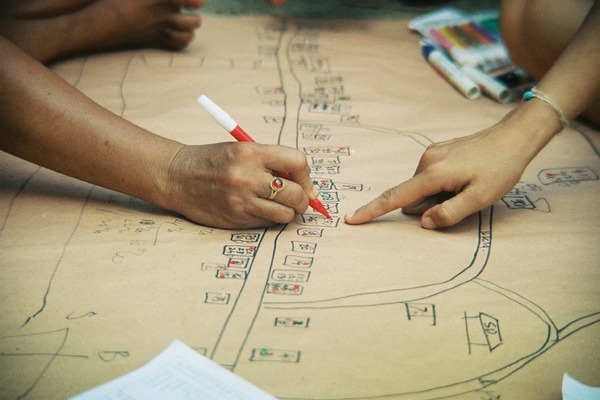 Photo by: Stewart Brown Some rights reserved
This Module is for those interested in low-cost, easily replicable, village-level initiatives related to spatially-defined issues. It also represents an entry point at the community level which can be up-scaled to more technologically rich mapping methods.
Module M09 - Participatory Scale Mapping and Surveying
This Module covers participatory mapping methods for scale mapping and surveying. Trainees are introduced to the relevant technologies and processes for making scale maps, including documenting community data on existing base maps, ground-truthing with a compass or GPS unit, making maps from scratch using compass surveys and GPS surveys. Scale maps are important tools for communicating community spatial information to decision makers. Whether negotiating specific land issues or planning detailed land use, it is important to know the size of areas or distance, the exact boundaries of areas or the precise relationship of one area or point to another. For these quantitative questions, scale maps are essential.
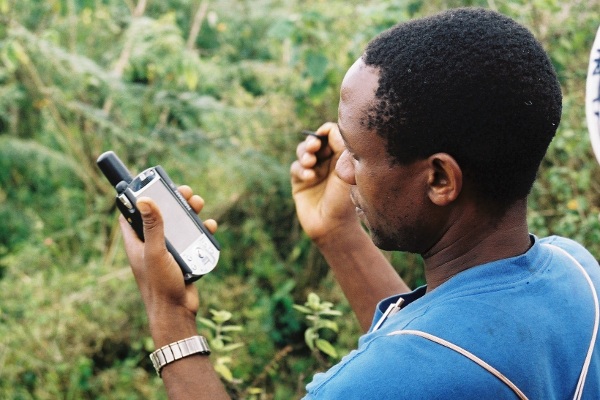 Photo by: Jeroen Verplanke Some rights reserved
This is a technically rich Module relevant for those dealing with scale mapping and field-based surveying techniques (including the use of traditional survey instruments, GPS and CyberTracker).
Module M10 - Participatory 3D Modelling
This Module covers a mapping method known as Participatory 3D Modelling or P3DM. It offers Units meant to introduce trainees to the method both theoretically and practically. This Module includes one Unit on legend making which is recommended for inclusion in all other Modules related to map making (M08, M09, M11, M12, M13, and M14). It also offers a Unit on data capturing using digital photography and georeferencing of the images obtained in the process. Further processing of georeferenced images is dealt with in Unit M12U04.
The delivery of this Module requires the construction of a small physical 3D model in advance of the training. Implementing Unit M10U03 also requires mobilising two or three residents of the area where the training takes place (local knowledge holders).
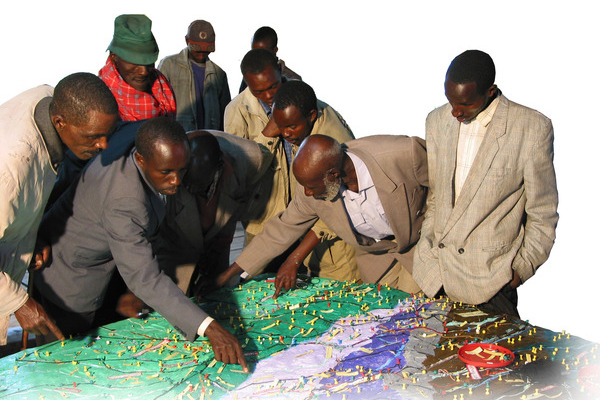 Photo by: Giacomo Rambaldi © All rights reserved
This Module is for those who are interested in both the methodological and practical aspects of participatory 3D modelling. This is a method that is well-suited for remote environments, and that offers local actors the opportunity to take full control of the process and outputs.
This Module includes one Unit on legend making which is recommended for inclusion in all other Modules related to map making (M08, M09, M11, M12, M13 and M14).
Module M11 - Participatory Mapping using Remote Sensing Images
This Module introduces trainees to aerial photography and satellite images and shows how these can be used for participatory mapping. The Module guides the trainee through the acquisition, processing and practical use of imagery.
The Module starts with the principles of remote sensing (RS) and explores the characteristics of aerial photographs and satellite images. Trainees are then introduced to the topic of image acquisition through mostly online sources of imagery. Guidelines for systematically interpreting these images are presented. The Module ends with trainees using remote-sensing images.
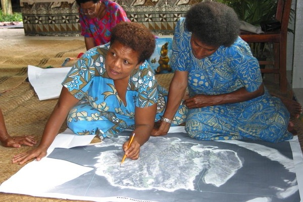 Photo by: Giacomo Rambaldi © All rights reserved
This Module is for those who wish to use aerial photographs or satellite images in participatory mapping. The Module also gives an introduction to image acquisition and the characteristics and pre-processing of imagery.
Module M12 - Introduction to GIS for the Purpose of Practicing PGIS
Abstract based on above summary: The use of Geographic Information Systems (GIS) has evolved from a process to be controlled by experts to one with a heightened capacity to represent and advocate on behalf of local communities. This shift has allowed a range of geospatial information management tools and methods to be more readily available. PGIS establishes the potential of these technologies to realise the greatest gains for local communities. The Module uses Quantum GIS, an open-source alternative to more expensive GIS software. The Module is composed of four Units which introduce the software, discuss data visualisation, demonstrate various GIS operations and assess the applicability of these kinds of technologies.
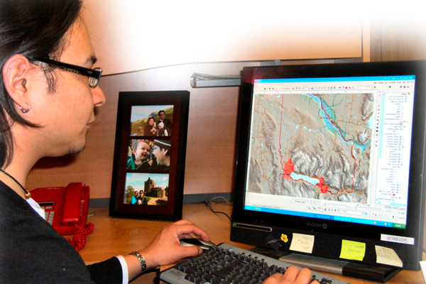 Photo by: Rachel Olson Some rights reserved
This Module presents a hands-on approach for first-time GIS users. Theories on GIS functionality are presented and supported by exercises that use Quantum GIS, an active open-source GIS project.
Module M13 - Participatory Internet-based Mapping
Internet-based mapping uses Web-based applications such as Google Maps and Google Earth. It has gained acceptance over the past few years because of its widespread availability and uncomplicated user interface that offer great potential for communicating spatial knowledge. This Module explores the theoretical and practical components of using online mapping methods to document and present spatial knowledge. It consists of three Units, which introduce the basics of Web-based mapping, provide tools for collecting, integrating and reviewing data, practise displaying and communicating local knowledge through online maps and discuss the risks and limitations associated with Web-based mapping.
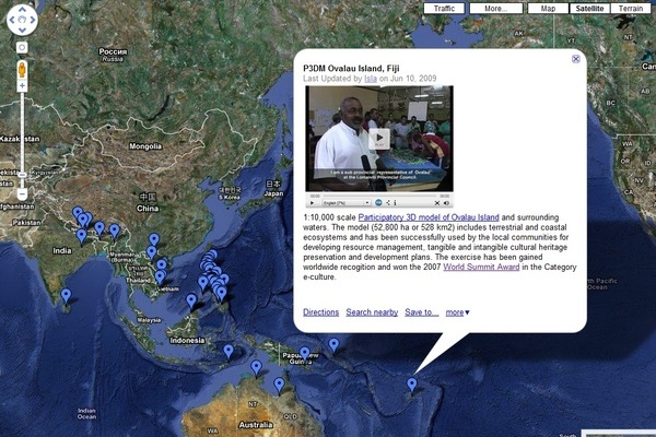 Photo by: Giacomo Rambaldi Some rights reserved
This Module is for those intending to engage in online mapping, such as with Google Maps or Google Earth.
Module M14 - Documentation
Fundamental to the success of any PGIS project is the integrity of the process by which the map evolves and the information that substantiates it. This Module focuses on the methods and tools of documentation and how the appropriate application of these tools can enhance the processes for participatory mapping activities. It consists of six Units, including an introduction to documentation, a review of interview techniques and note-taking procedures, practical lessons on the fundamentals of participatory video, picture taking (Photo Voice), audio recording and evaluating the mapping programme and the collected data.
 Photo by: InsightShare Some rights reserved
This Module covers the theoretical and practical methods for documenting and communicating the processes and outcomes of participatory mapping initiatives. A range of tools and methods are presented, along with tips and advice.
Module M15 - Making Maps Work: Planning, Communication and Advocacy
The Module helps practitioners consider how advocacy, rights and capacity building are integral elements in ensuring that mapping methodology serves a positive end. The trainees are introduced to methods of planning, monitoring and evaluating the advocacy components of participatory mapping. The Units guide the trainees in elaborating a communication strategy and expose them to group-action tools and techniques that can make participatory maps serve given purposes.
The Module promotes awareness of community cohesion, external networking, alliance building and advocacy capacity building at different policy levels, each relating back to participatory mapping methods and processes. Attention is given to diversity within communities and international standards for rights of indigenous peoples.
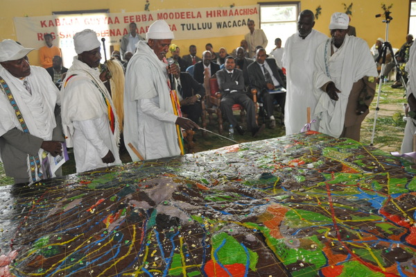 Photo by: MELCA Mahiber Some rights reserved
This is a Module of interest to those wanting to go beyond “map making” and add value and communication power to local spatial knowledge. Useful for those planning to use community-generated maps in advocacy campaigns or as a means for negotiation.

 For Trainers
 For Trainees
 For Trainers and Trainees